Geographical Information System (GIS) & Remote Sensing
Where creativity meets strategy to transform your social media presence. We are a passionate team of digital enthusiasts, designers, and marketers who are dedicated to helping businesses thrive in the ever-evolving world of social media.
From Static Maps to Strategic Superpowers
“Aqvaspace Sdn Bhd turns complex spatial data into the answers you need to navigate a changing world”
In a world defined by data, location is the common thread that connects every challenge and opportunity. At Aqvaspace Sdn Bhd, we believe that Geographic Information Systems (GIS) are more than just digital maps—they are a superpower for decision-making.
We move beyond traditional cartography. By layering complex data into intuitive visual intelligence, we empower your organization to see the patterns others miss. Whether you are optimizing critical infrastructure, protecting natural resources, or solving logistical puzzles, we turn static data into spatial clarity, giving you the absolute confidence to act.
GISApplication
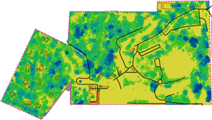
Agricultural Planning & Zoning
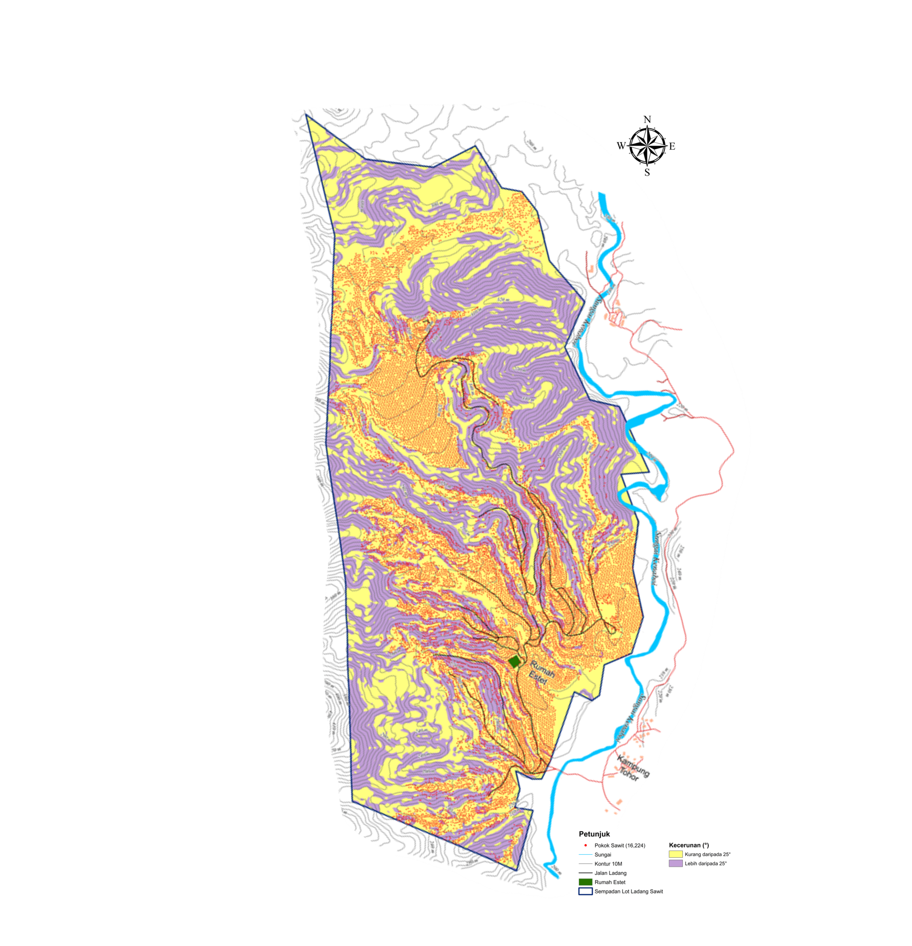
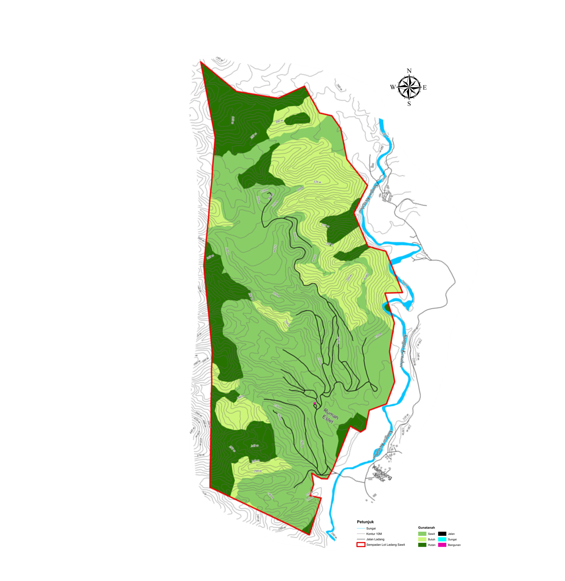
Integrating land-use mapping with slope and elevation analysis to establish a high-fidelity foundation for sustainable land management and agricultural suitability
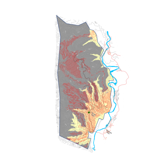
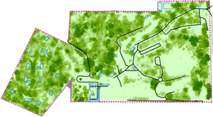
Orthophoto Map
Elevation Map
Slope Map
Land Use Map
A Geospatial Approach to Smart Water Management
Integrating land-use mapping with slope and elevation analysis to establish a high-fidelity foundation for sustainable land management and agricultural suitability
“Precision Data for a Greener Future: Advanced Carbon Sequestration Mapping”
“Precision Data for a Greener Future: Advanced Carbon Sequestration Mapping”